The Top of the World
Ever wondered what the top of the world looks like?
Here it is, in satellite view. You can make out North America clearly underneath the North Pole. You've got massive Alaska on the left, and you can see Florida protruding from the continent at the bottom right.

If you have not yet encountered Google Earth, give it a go. Satellite and aerial imagery are combined to provide stunning views of the world. Some areas are higher resolution than others.
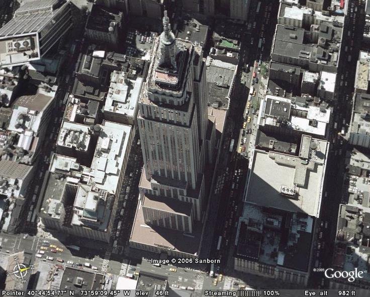
Here, for example, is a fairly high res view of the Empire State Building.

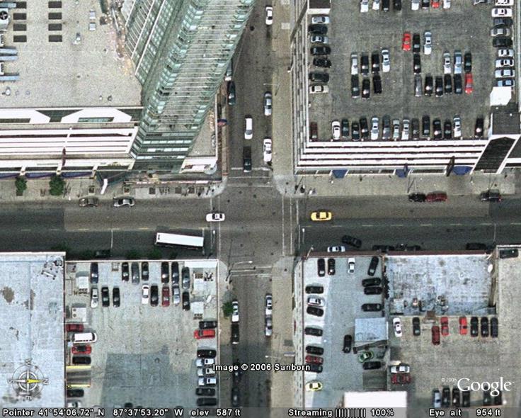
Chicago is also captured in high resolution. You can zoom close enough to see which vehicles have sunroofs, and you can even see the lines on crosswalks.

You can take a virtual tour of famous landmarks.
My favorite is the Grand Canyon, because the terrain feature allows you to whisk around the canyon 3-D style, as if you were flying through it. It's AMAZING.

Pearl Harbor is a fascinating visit as well, as you can see the submerged ships. But I'll leave that for you to explore!
Tags:
posted by Michelle at
2:30 PM
![]()
2 Comments:
Cute name for a post. This sounds like a site I will have fun checking out.
By Jessica Harwood, at 4/08/2006 10:10 PM
I heard that the government has the capability to take much higher resolution photos, but they won't release them for public use, because of national security.
By Becky, at 4/11/2006 7:59 AM
Post a Comment
<< Home